Excited today to receive our GR11 maps….all 46 of them!

And with the maps comes the sense of reality, and mild panic- only 3 months to go until we hit the trail on 1st August. Although not as well know as the Appalachian or Pacific Crest Trails in America, the GR11 is major long distance hike, traversing one of the most spectacular landscapes in Europe. A total of 508 Miles (820km), and with elevation gain equivalent to climbing Everest 4 times, a GR11 thru-hike is not for the faint-hearted!
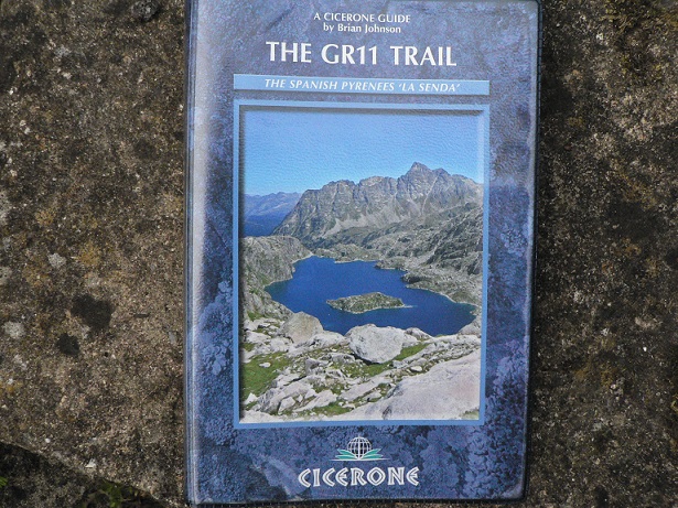
Most GR11 hikers start from Cap de Higuer on the Atlantic coast of Northern Spain and finish at Cap de Creus on the Mediterranean. This is the direction we will also walk, mainly because it is the direction described in the excellent Cicerone guidebook by Brian Johnson ‘The GR11 Trail- La Senda’.
The map set produced by Prames (1:40,000) is a useful addition to the Cicerone guide, giving a slightly wider view of the surrounding terrain for orientation and for planning town resupply stops.
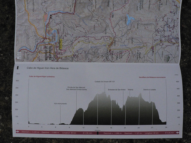
A useful feature on the Prames maps is the route profile for each stage, letting us know what punishment we are in for beforehand! I assume/hope the vertical scale is exaggerated… The maps are printed on both sides saving weight and space, and represent a considerable saving over buying individual maps for the whole route.
The miles in between the two coasts are spent traversing the wooded hills of the Basque country and Navarre before climbing into alpine terrain, including an excursion into Andorra, before the final sections through Catalonia and the dry hills down toward the Mediterranean. Along the way, GR11 hikers are treated to sections through 2 National and 6 Natural Parks, including the famous Ordesa Canyon and Aiguestortes National Parks. For us, it is not only the spectacular landscape that is a draw, but Pyrenean wildlife also abounds, including the Lammergier, Griffon and Egyptian vultures, eagles and alpine butterflies.
The Cicerone guide covers the GR11 in an ambitious 45 stages, this is to accommodate those hikers who need/want a proper bed each night. This would involve some hard days, both in terms of distance and altitude gain/loss, so camping offers more flexibility and the chance to camp high in mountains- a key attraction for us. We will carry all our gear (kit info to follow) and wild camp as much as possible, aiming to re-supply every 2-3 days. Logistically the GR11 is easier than some of the longer wilderness trails, dipping down to small towns/villages with shops/cafe’s (hence the 4 Everest ascents!), or passing refuges every day. With the amount of wild camping planned, we aim to stay in a Pension or Casa Rural about once a week, and will supplement our camp cooking with meals in cafes etc as needed.
Speed is not our priority, our main aim being to absorb the mountains and have the flexibility to explore places en-route that we like. Based on this we have allowed 2.5 months (75 days) for our trip- a generous figure which may change as our trail fitness improves. Despite our pre-hike preparation, starting in August (the hottest and busiest month) and carrying full kit, the first two weeks on the trail will be shock to the system. Temperatures of over 35 degrees are not uncommon so careful attention to re-hydration and rest stops will be key. Later on, in the higher mountains, fierce thunderstorms mean careful planning of exposed ridge walks. Ideally we would have liked to avoid August altogether, but the length of the route and relatively short seasonal window (between late snows in June and early snow in October), mean that it is hard to avoid for the average thru hiker.
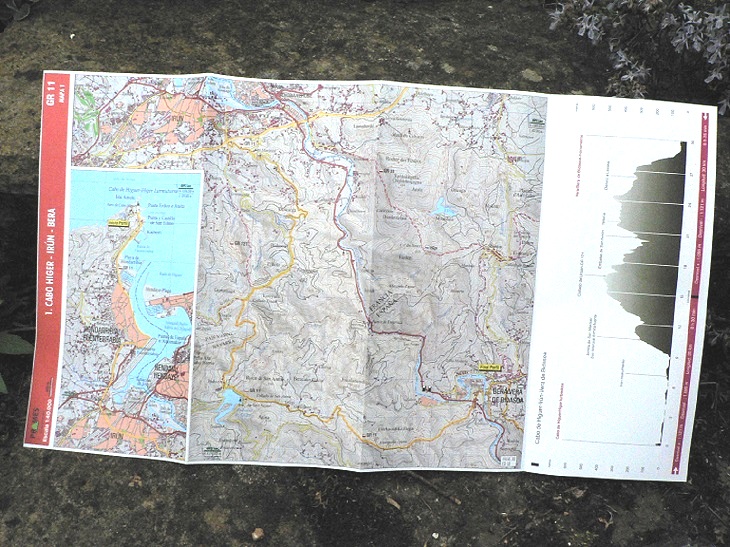
Image: Shows map 1 of the Prames set, a 30km stretch (yellow line) from the coast at Cabo de Higuer and up though the Basque hills to Bera.
Anyway, that’s enough of an intro to the GR11 for now. We will be posting more detail over the coming weeks on out kit, preparation and walk strategy which we hope will be of use to others contemplating this trail. From our own research there are a few other blogs out there on the GR11, some of which are getting a little dated, but there is nothing like the amount of info available for the PCT or AT- so we will try to redress some of that. Thanks for reading!


I’m planning on thru hiking the GR11 late summer 2016 and your blog really is proving to be a great resource for what to expect and prepare for! There really aren’t that many blogs about thru hiking this trail…
I was wondering though, would you recommend buying the Cicerone maps or can I do without them? Might save some weight 🙂
LikeLike
Hello. Thanks for your comment. Yes, when we were planning the GR11 there was not much information available about thruhiking the trail, so I am glad you are finding our blog helpful. We walked from the Atlantic to Mediterranean and followed the excellent Cicerone guidebook by Brian Johnson. We also had the maps produced by Prames, but we hardly needed to use them as the guidebook instructions were so good and so were the trail markings in most places. The Prames maps seemed hard to read, and several hikers we met that were using them said they were not very accurate. It depends on whether you feel you need extra back-up for navigation. The only thing we found useful with the maps was that they gave us wider ‘visibility’ of the terrain- which is useful if you need to short-cut or come off trail for any reason. A smartphone with a gps app could be another (lighter) alternative to maps. If you have any more questions let me know and I’ll try to help, best of luck with your hike and it would be great to know how you get on.
LikeLike
Whoops, I meant the Prames map set yes. I already have the Cicerone guidebook and it seems very helpful indeed, especially with water locations and possible camping grounds. I will already be carrying a smartphone so I’ll probably will not buy the Prames set then! Thanks for your reply! I’m quite excited to start the hike but also slightly nervous, especially as I will be attempting a solo thru hike (couldn’t find a friend determined enough to hike for 30, 40+ days…)
Anyways, if in my preparations I come up with more questions I’ll let you know. Best of luck with your GR1 adventures!
LikeLike